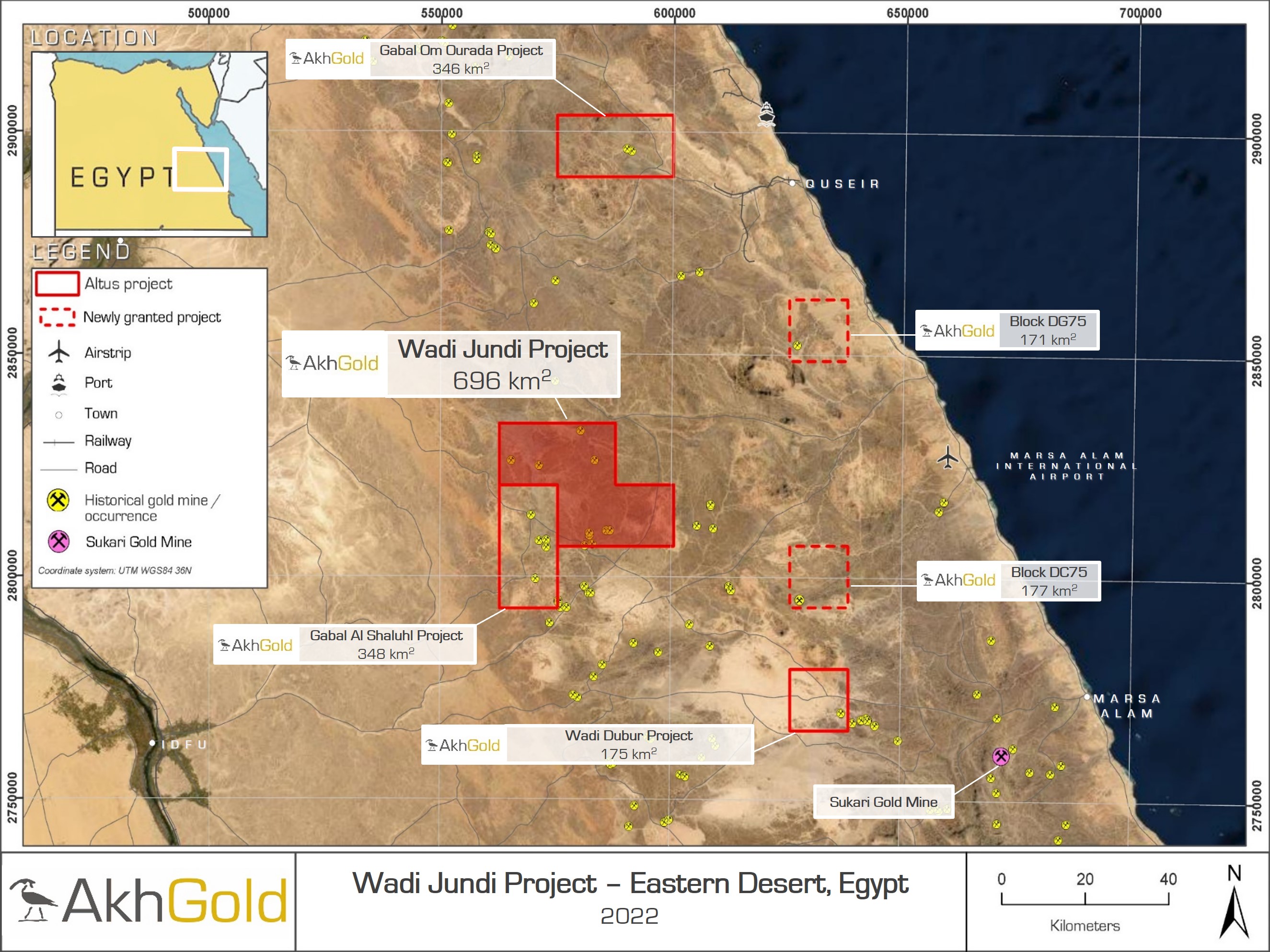
| Project: | Wadi Jundi (696 km2) |
| Commodity: | Gold |
| Location: | Eastern Desert, Egypt |
| Deposit Style: | Orogenic gold and VMS System |
| Key Attributes: | Historic gold occurrences, granites and ophiolites |
| Asset Stage: | Target definition and prospectivity mapping |
| Results: | Coming soon |
| Next Phase of Work: | Reconnaissance mapping and sampling |
Overview
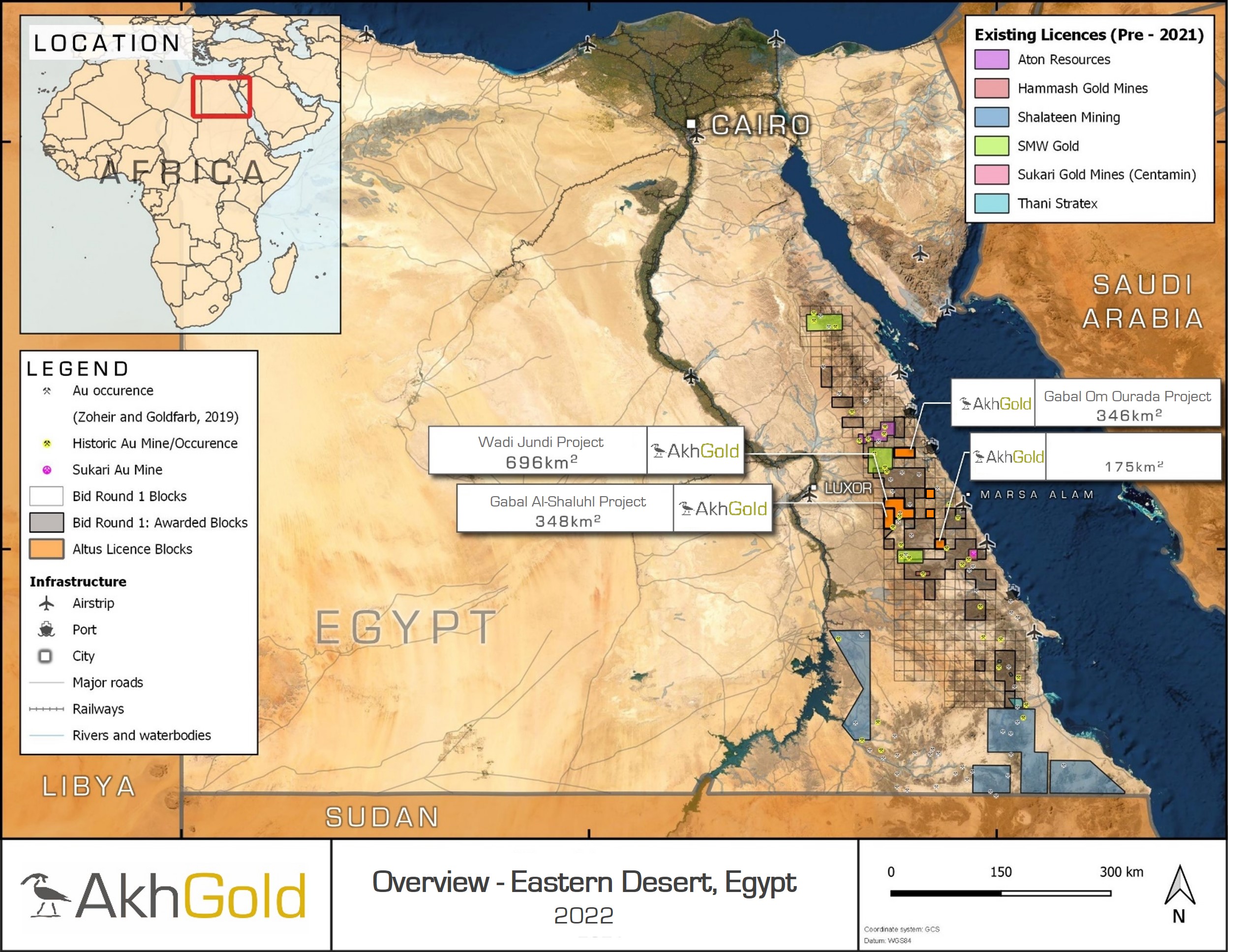
The Wadi Jundi project consists of four licence blocks (granted as part of the 2020 International bid round), covering a total area of 696 km2 in the highly prospective Eastern Desert of Egypt. The project is located approximately 40 km south of the historic El Sid gold mine, which contributed around 45% of Egypt's gold production during the 20th century, and 115 km north-west of the Sukari gold mine (operated by LSE listed Centamin Plc) which produces approximately 400,000 oz of gold per annum. It is directly accessible by secondary tracks from the Al Kosair-Qena asphalt highway, which runs along the licence's northern boundary and connects the city of Luxor and coastal town of Quseer. Altus holds a 100% interest in the project and is exploring primarily for gold, specifically targeting orogenic gold mineralisation in folded volcanics proximal to a granite intrusion and potential gold-bearing Volcanogenic Massive Sulphide (VMS) mineralisation hosted in a seafloor sequence.
The Eastern Desert of Egypt forms part of the north-western limb of the Neoproterozoic Arabian-Nubian shield, a rapidly emerging world-class province for orogenic gold deposits, with reported discoveries of >45 Moz Au and Au equivalent in the last two decades. Historic mining in the Eastern Desert dates back to Pharaonic times. Large areas of the Eastern Desert remain relatively underexplored and provide highly prospective greenfields targets.

Exploration Programme
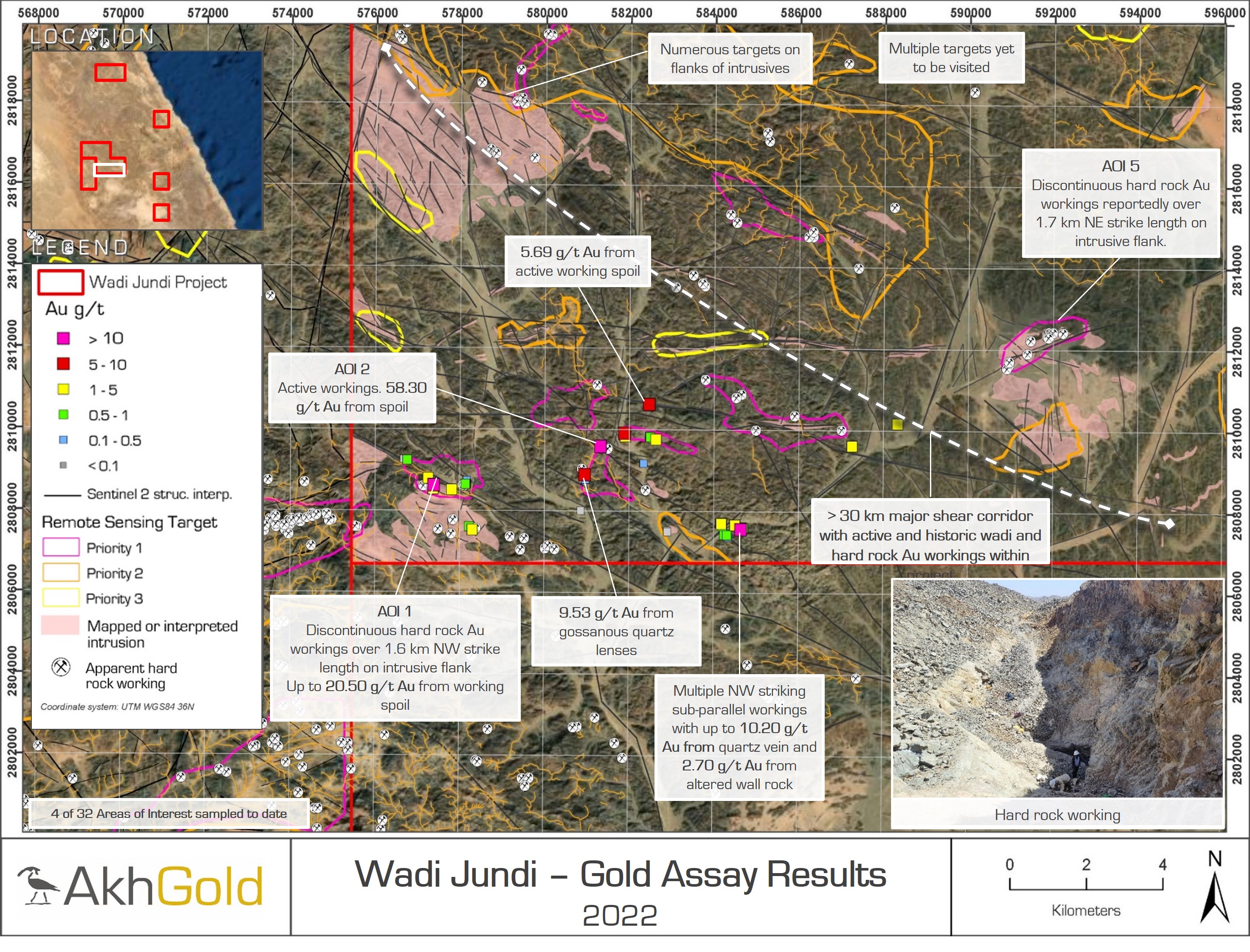
Akh selected Wadi Jundi based upon an extensive process of desk-based prospectivity mapping. This work comprised a review of available datasets, including historical mineral occurrences, geological maps and satellite-borne remote sensing data. The licence contains a north-west trending ophiolite belt comprised of favourable seafloor lithologies. A basal serpentinite melange is overlain by calc-alkaline basic to acidic volcanics, capped by reworked volcaniclastics, which are in turn overlain by schists. The entire sequence is intruded by syn- to late- tectonic mafic intrusives and late- to post- tectonic granodiorite, granite and monzogranite intrusions, the latter being comparable to that at the currently operating Sukari gold mine. The project is located just south of a major north-west trending Najd fault corridor which hosted some of the most extensive gold mining during the 20th century and Pharaonic times. A first phase reconnaissance exploration programme is underway focused on a 30 km shear corridor with active and historical wadi and hard rock gold workings, rock chip and spoil samples from working have returned results including 58.30 g/t Au, 20.50 g/t Au and 10.2 g/t Au.
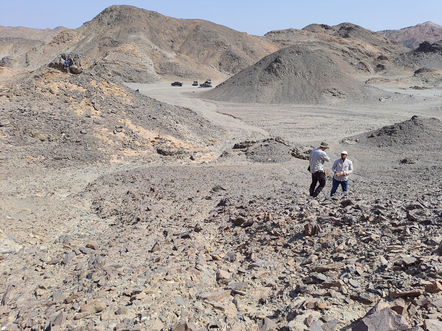

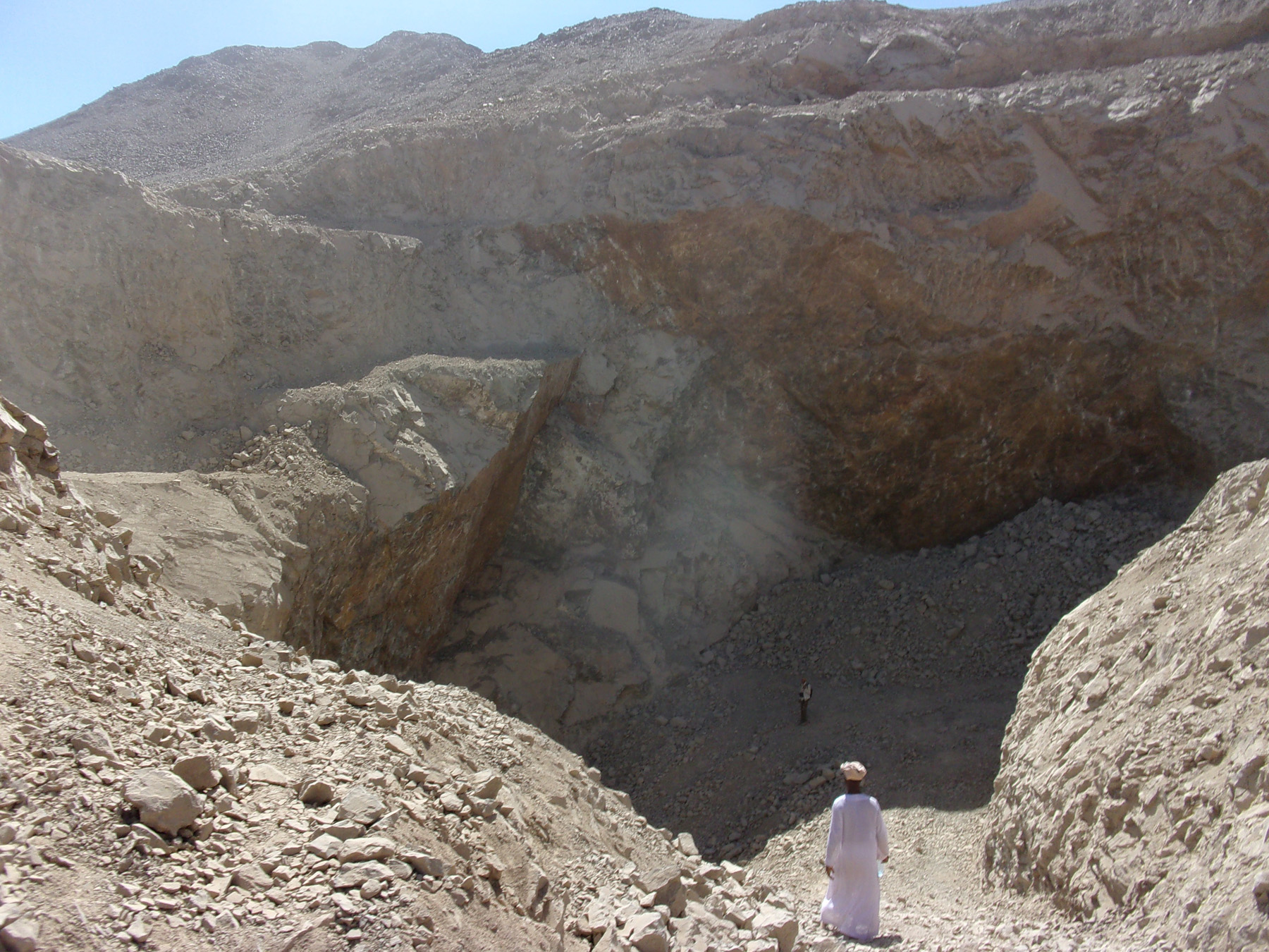
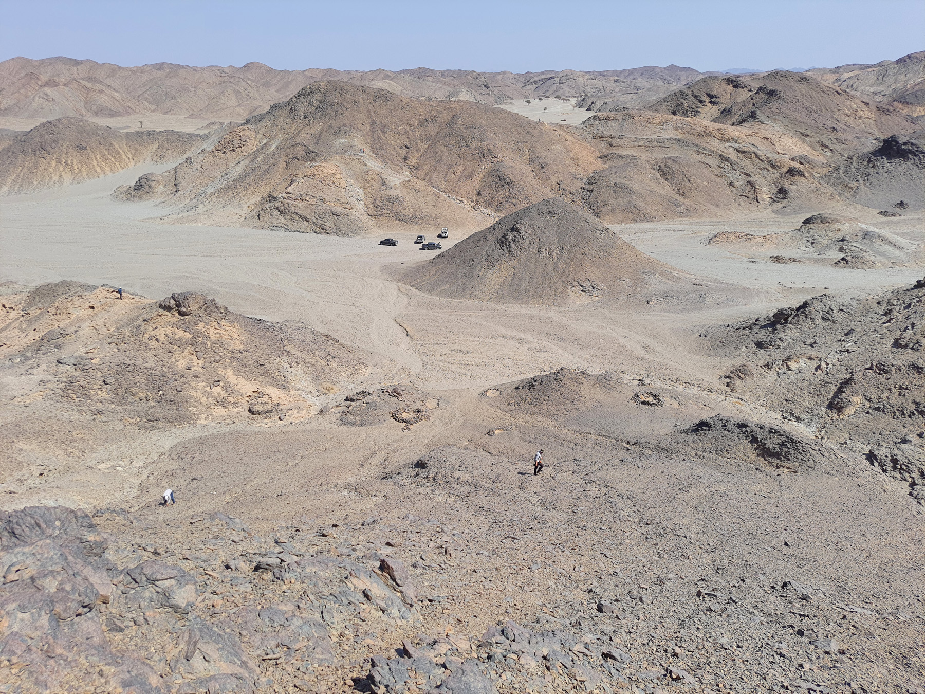
Photo Gallery


